Help support this site by using our Amazon or Six Moons Design buttons for any purchase
Torres del Paine:
We have backpacked the circuit two different years. The W route is a subset of the circuit. I did do an extensive blog entry when researching the trips, and updated it afterwards: My Blog entry on Torres del Paine preparation - I've incorporated some of the post's more useful information here.
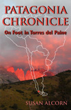
Since that time Susan has incorporated all that information plus her journal experiences and more into a book: Patagonia Chronicle: On Foot in Torres del Paine. That book is described more fully on its own web page Patagonia_Chronicle.
At the moment our most recent information is in the book, but as we get updated information I will add it here.
Campsite Reservations Update 12/14/16
TDP has gotten very popular, and instituted campsite reservations during the 2015-2016 season. At that time they were loosely enforced but reports are coming back from those hiking now (Dec 2016) that reservations are being checked and those without reservations are being forced to hike on (Camp Paso for example).
The Fantastico Sur Reservations sites are Camping Central (the big one in the Las Torres area at the beginning of the W route, Camping Los Cuernos, Camping Serón, Camping Francés, Camping El Chileno.
Vertice Camping Reservations handles Paine Grande, Grey, Dickson and Los Perros Camping. For Vertice, their website says reservations must be made at least 5 days ahead, and if it is less than 5 days, then visit their offices in Puerto Natales at Bulnes 100 and Bulnes 1202.
Also, you must reserve the free CONAF camps - Campo Italiano, Campo Paso and Campo Torres (at the foot of towers, not the one at Las Torres)
*** important *** Argentine government now requires a reciprocity fee for US citizens, which must be prepaid by credit card on their website. See their link for details. embassyofargentina.us/embassyofargentina.us/en/consularsection/tramites/reciprocityfee.html
One question that has come up from a reader is "Where can we charge our devices while on the circuit?". The short answer is don't depend on it. Take enough spare batteries to last you for eight days. We took two camera batteries apiece. In the outlying refugios (Dickson, Chileno, Grey) they have generator power, and if you are staying in the refugio or can convince someone on the staff, you might be able to get a couple of hours of charging. I think that in the Torres Central Refugio there was an outlet in the dorm room. We got the bartender there to charge our batteries while we were at the bar.
One important link has changed since we put the book out. CONAF is redoing their web site, so the official map is no longer at parquetorresdelpaine.cl/maps.html. There is a copy of it at www.torresdelpaine.com/img/portada/mapaPAINE.jpg
Guidebooks
When we did this trip there were only two guides available that were at all useful, The Lonely Planet guidebook for the area and the Moon Guide for the area. Since then Cicerone has put out a guide for Torres del Paine, and Susan's book is available.
Torres del Paine: Trekking in Chile's Premier National Park (A Cicerone Guide), Rudolf Abraham. This wasn't available when we hiked, but it is the usual excellent very detailed Cicerone guide on hiking the trails of Torres del Paine.
Patagonia Chronicle: On Foot in Torres del Paine, Susan Alcorn. This provides a hiking guide that falls somewhere between the Lonely Planet guide and the Cicerone guide. Her journal narrative provides a sense of what is actually like to hike the Circuit. The planning section provides an excellent guide to making the trek, and the human history and Patagonia Today chapters complete the picture.
Moon Patagonia Including the Falkland Islands, Wayne Bernhardson. We relied on this for information on the Lake District and broad Patagonia information.
Trekking in the Patagonian Andes (Lonely Planet), Carolyn McCarthy. This has general area information, but we mainly used it for its nine day plan for hiking the Torres del Paine Circuit.
Maps and Other Links
My blog post was mainly about useful links. Maps were a major concern. A useful map link:
www.torresdelpaine.com/ingles/secciones/02/a/mapas.asp#
One of the best trail maps: http://www.interhabit.com/torres_del_paine/map_615.htm click on the Torres del Paine map at the bottom of the page.
Cariedaway has one of the best blog posts I have seen on the nitty gritty of hiking Torres del Paine, including a hand marked up trail map that I particularly like: cariedaway.blogspot.com/2013/12/planning-your-trip-to-torres-del-paine.html
Besthike.com has a good writeup on tdp, including some maps that highlight the W and Circuit: www.besthike.com/southamerica/chile/paine.html
I found some sites with gps maps, and others with gps tracks, but didn't find them accurate during our trip - offset about a mile, so I must have had wrong base. Gps was unneeded anyway, as the routes were fairly obvious, even when trail markers were confusing.
Fuel
The hardware stores in Puerto Natales sell white gas - it's called bensina blanco.
You can buy isobutane canisters in town the brand is Doite - from Korea. We got canister in Punta Arenas, numerous stores sell in Puerto Natales. Also, Torres alburge Central - the big refugio that you first get to if entering from Laguna Armarga, had canisters but I would try to get it earlier, eliminating worry about shortages.
Transportation
Transportation is a little tricky. Argentina and Chile don't get along all that well. There are three towns you need to remember. Punta Arenas on the Strait of Magellan, the largest city in the area and a transportation hub for Chile, is where you would fly into from Santiago, then bus north to Puerto Natales, the gateway town to Torres del Paine. North of Torres del Paine and Puerto Natales is El Calafate - the Argentina transportation hub. From Argentina you can also fly in and out of Ushuaia or Rio Gallegos and fly from there to Punta Arenas. There are daily buses from Puerto Natales to El Calafate. Currently buses leave Puerto Natales for Laguna Amarga, Pudeto and Administration at 7am and 14:30.
According to the fslodges.com , there are buses leaving Punta Arenas every one to two hours for Puerto Natales, starting around 7 am. Catch Buses Fernández at Armando Sanhueza 745, or Bus Pacheco at Avenida Colón 900 or Bus Sur at José Menéndez 565.
From Puerto Natales, buses leave for the park at 7:00 am and 2:30 pm - Buses Gomez at Arturo Prat 234, Buses JB at Arturo Prat 244 or Buses Turismo Maria Jose at Bulnes 386.
Buses Gomez site is: http://www.busesgomez.com/ When I last checked, they left Laguna Armarga for Puerto Natales at 15:00 and 19:45. You would catch a shuttle at Las Torres Refugio to connect at Laguna Armarga.
You can bus from Puerto Natales to El Calafate, and from there get a flight to Buenos Aires for about $290. It can vary by day of week. Our plane was full leaving, so book in advance. You can get a ticket from Punta Arenas to Buenos Aires, but it routes you thru Santiago and costs more. For Brazil flights: http://plane.lan.com/index-en-us.html
There is also a little Argentine town south of Punta Arenas - Ushuaia and people can fly in and out of there, to Buenos Aires, but costs more than El Calafate.
Our 2010 route was to fly from Santiago into Puerto Montt, stay at Puerto Salas a couple of days and then take the Navimag ferry to Puerto Natales. After that, same as last year. Note that there is only one ferry a week from Puerto Montt to Puerto Natales.
Costs as of Feb 2013
For 1 person economy - for a 12/15/13 depart, 1/6/14 return, sfo to Santiago, Buenos Aires to sfo = about $1600. Double that for immediate departure so book flight well in advance. We booked the flights from Santiago south and return to Buenos Aires separately thru LAN.
For Santiago to Punta Arenas $514
For El Calafate to Buenos Aires $284
For Santiago to Puerto Montt $214
Navimag ferry, bunk in dorm $420.
In Torres del Paine, we always camped, but bought breakfast and dinner when available. On a per person basis, breakfast and dinner was about $42 US dollars, and campsite $16, so about $120 per day at the fee sites for the two of us for 7 or 8 days (two days were at free camping sites). It's not possible to reserve campsites in advance, and not necessary. There are not individual sites, just a big area designated for tents, and you setup where you want or can find space.
As we were camping, we had to pay in Chilean pesos, which include a 20% tax not in the published dollar rates, so the $120 above is adjusted for that 20%. i.e. we paid in pesos and I'm giving you the dollar equivalent. We brought about $800 Chilean pesos from home, and also used ATMs in Santiago and Punta Arenas. For Argentina we just used ATMs and credit cards.
Food on Circuit
We had a 10 day plan for the Circuit.. We planned on eating breakfast and supper in refugios and carrying 3 days of food for the cases where there was no refugio with food. We carried lunches for every hiking day. Los Perros is staffed, but doesn't prepare any meals, so we needed dinner and breakfast for there. From Los Perros is is 22km over Garner Pass to Grey Refugio, the next one with food. We stopped instead at unstaffed (and free) Campamento Paso, only 12km from Los Perros. Our next unstaffed stop was at Campamento Italiano. The remote refugios only have radio communications so don't take credit cards. Las Torres refugio does take credit cards.
Electricity:
240 volts. You need the round 2 prong adaptor for Chile (3 if ground required), Argentina 2 round or two diagonal. Remember that you need a voltage converter, not just a plug adaptor if your appliance requires 110 volts. My camera battery charger will convert 240, but my cell phone charger will not.
Water
The refugios all had water from a faucet, and we drank it unfiltered with no problems. One day a storm knocked out the water at Seron, so I filtered muddy water from a stream using our ULA gravity filter. At Italiano and Camp. Paso got stream water. Carry water purification tablets for backup.
Raingear
We both had Packas - rain parkas with sleeves, zippers, and a big hump for the backpack. Worked fine, but only protects to about the crotch. We also had rainpants. Also, I carried Seal Skinz waterproof socks.
Our Gear List
We used essentially the same gear list as our state of Washington Pacific Crest Trail list included below. Any changes for Torres del Paine are noted:
This direct link to the Google spreadsheet should allow you to save as an Excel file:
Google Sheets File
Our 2010 Route
Day 0 sleep in Puerto Natales.
Day 1 16.5 km Take bus to park gate at Laguna Amarga and take van shuttle from there to Las Torres & start counterclockwise hike from there. Hike to Puesto Serón and camp (in tent). If weather is good, at Las Torres, do side trip to towers and camp at Las Torres and increase schedule by 1 day. *** post trip note *** we arrived in good weather, hiked to Camp Chileno setup camp, went on to towers and returned to Camp Chileno, next day just went to Las Torres, and day after that went to Seron. ***
Day 2 Puesto Serón to Refugio Lago Dickson 18.5 km.
Day 3 Refugio Lago Dickson to Campamento Los Perros 9 km *** this was a very long day - took us about 7 hours ***
Day 4 Campamento Los Perros to Campamento Paso 12 km - about 2100 ft up and 2400 ft descent. *** we didn't go over pass due to strong winds and weather - backtracked to Las Torres ***
Day 5 Campamento Paso to Refugio Grey 10 km
Day 6 Refugio Grey to Campamento Italiano est 16 km 900 ft ascent/descent.
side trip Valle del Francés est 8 km
Day 7 Campamento Italiano to Los Cuernos est 13 km
Day 8 Los Cuernos to Hosteria Las Torres est 11 km 600 ft up 300 ft down and side trip to the towers.
Day 9 sleep in Puerto Natales *** Stayed at Casa Cecilia - left extra bag there on the way to the park (we had several hours in Puerto Natales before catching the 2:30 bus to the park. ***
John Garner Pass or John Gardner Pass - the definitive answer
John Garner Pass. This was answered by John Garner himself in an interview with Anne Crawford of the Sydney Morning Herald, Travel, November 13, 2008. Ms. Crawford encountered Mr. Garner at Refugio Grey, along with his two ranger friends, Pepe Alarcon and Oscar Guineo, They had pioneered the Circuit trail in 1976, and were having a reunion. See her full story for more details. smh.com.au/world/south-america/ice-bold-20070210-gdpfr1.html?page=3#
Emma Gatewood first hiked the entire 2160 mile Appalachian Trail at the age of 67. She last hiked it at the age of 76.
Page Changed: February 1, 2020 16:20
[Home][Top of Page] -
Please send comments, suggestions to backpack45 circleatsign yahoo dot com
All
text and images copyright © Shepherd Canyon Books - 2003 through 2020
“backpack45.com is a participant in the Amazon Services LLC Associates Program, an
affiliate advertising program designed to provide a means for sites to earn
advertising fees by advertising and linking to amazon.com”
